
Location to Intelligence – geospatially
Geospatial-intelligence allows users to hold and pass knowledge effectively. It ensures delivery to where it needs to be, in a cost-effective manner. GMAPSNZ is here for you to create geospatial-intelligence products that meet your needs.
Geospatial-intelligence, imagery production, map production, and data science – know your data with GMAPSNZ.
Contact us today to discuss your needs and opportunities
We look forward to working with you.
GMAPSNZ provides imagery production, visualisation aids, terrain analysis, and geospatial advice.
Imagery Production – keep flying for longer. Maximize your profits and enjoy the outdoors, while we do the heavy lifting of imagery production for you.
Our quality assured method with SimActive Correlator3D delivers clipped and tiled imagery.
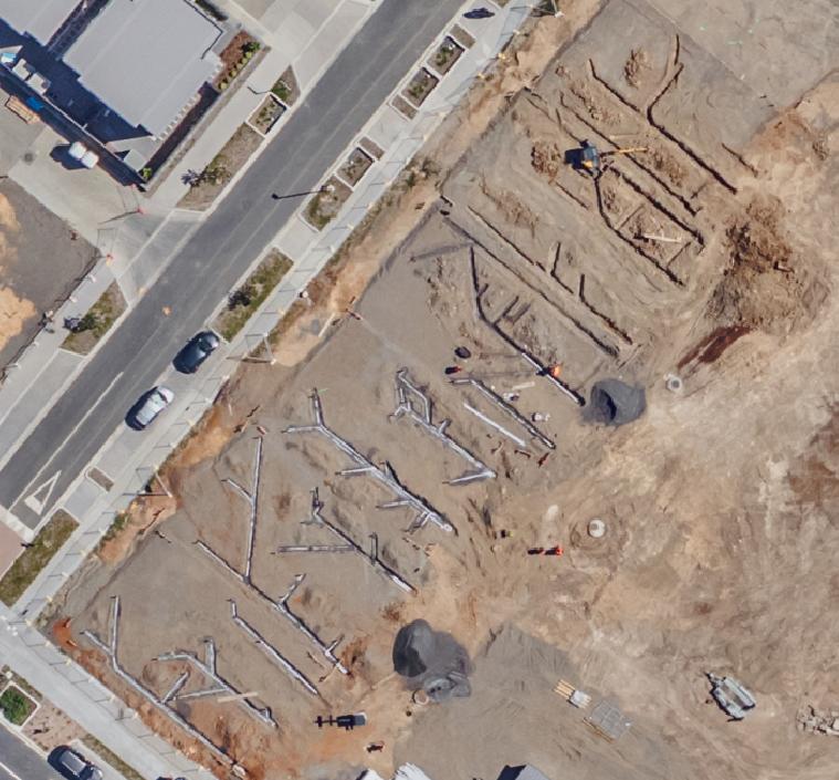
Visualisation aids – perfect for your construction plans, regional and urban planning, change detection, resource consent, and evidentiary requirements.
You get the right scale and resolution for your needs.

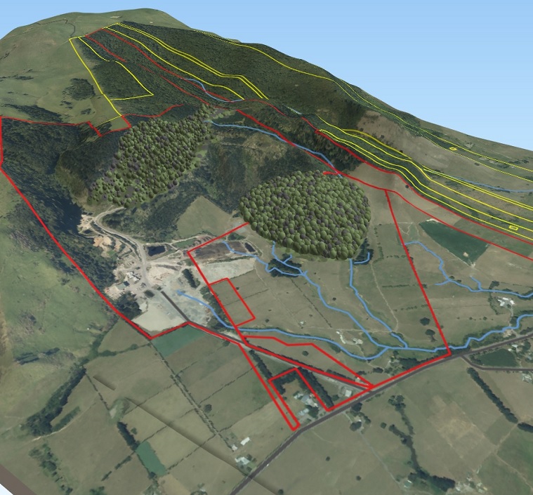
Terrain analysis – our approach offers a comprehensive method to gather data for all your planning, application, and compliance needs.
Proven inputs for Farm Environment Plans (FEP), with data from UAV Mapping NZ Ltd and Action Aviation; operating Cessna 172 and UAS compliant with NZ CAA.
Geospatial advice – upskilling you and your team, by providing mentoring, coaching, documentation, and skills transfer.

Get the GMAPSNZ geospatial-intelligence advantage
Geospatial technologies are increasing rapidly. Complexity and risk means uncertainty that others take advantage of. Working together with GMAPSNZ you’ll obtain a geospatial-intelligence advantage that only GMAPSNZ can offer.
Managing your mahi work into four steps, we’ll achieve great results:
- Direction
- Collection
- Processing
- Reporting
Our process ensures the successful delivery of mātauranga knowledge of the whenua land and features to you and your end users.
Direction
Working with you to understand the intent and purpose of your needs.
Identifying the implied tasks which need achieving for your success.
Working with you to ensure Data Management Planning and protection for your data.
Collection
Working with leading aerial service vendors to capture imagery from a range of platforms, to deliver on time and to the correct specification.
From drones and light planes with LiDAR and reliable cameras, to historical photos and personal narrative – GMAPSNZ collects this for you.
Processing
Production of multiple datasets at the resolution fit for purpose.
“Create once, Use many” to save you time and money.
Proud to use SimActive Correlator3D for reliable, accurate, and fast image processing.
Know where your data came from with GMAPSNZ.
Some of GMAPSNZ deliverables
Sample Reporting Products
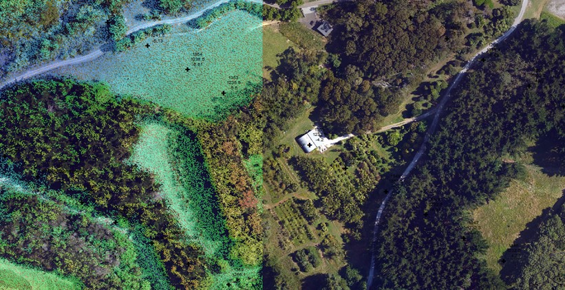
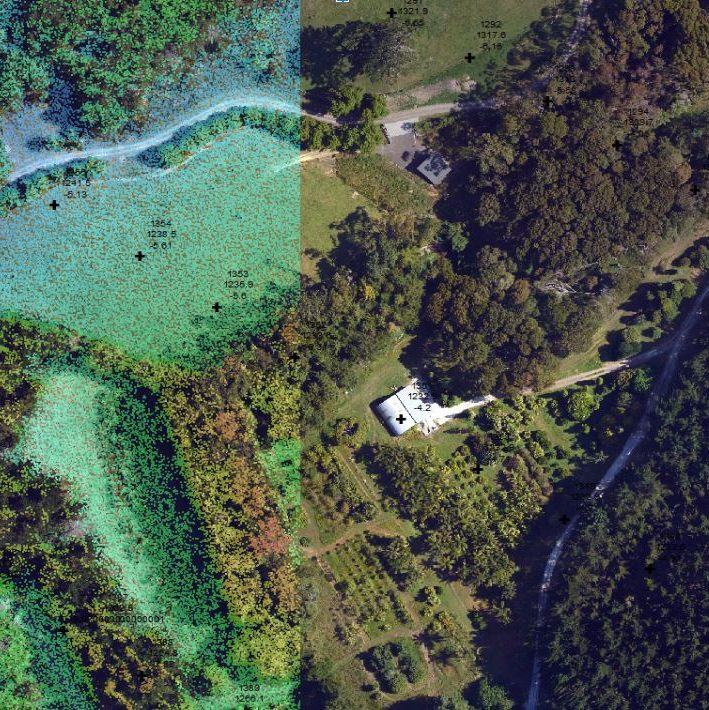
“What was there?” Prior to resource consent, this pātai question was raised but not addressed with current “as is” data. GMAPSNZ identified the collection gap and applied rigours controls to ensure an accurate and appropriate visualisation could be used.
This gap in the basedata meant end-user concerns were not being addressed by reporting from other vendors, who didn’t see the data with the same insights as the mana whenua.
For this mahi task GMAPSNZ re-created the terrain using photogrammetric methods with historical imagery (dated 1948), using SimActive Correlator3D. Furthermore, the ‘up to date’ LiDAR data did not cover the area the end users identified with. Delivery included a web-page visualisation tool which could be used off-line, accompanied by detailed reporting that addressed the fundamental question “what was there?”
Data Analytics GMAPSNZ can work with you to analyse and close your information gaps, This increases your confidence to make decisions, allowing your increased resilience, and continues your leverage of data to drive mission outcomes.


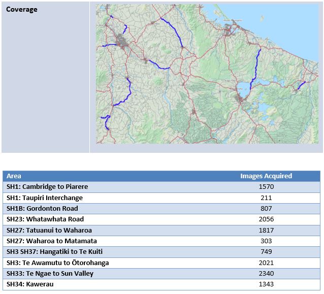
Oversight of Regional Products. GMAPSNZ can develop and produce bulk specialised data products for your safety initiatives at all scales. An example is imagery for the Road Safety Alliance; 10 major roads, 13,216 images, and 5 days flying. Results of quality processing and delivery working with UAV Mapping NZ Ltd,.
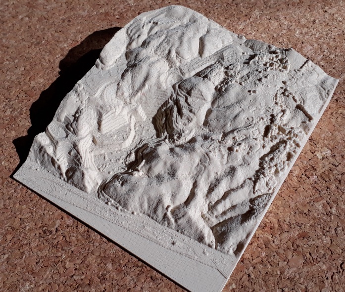
Value-added product from incidental collection – a physical site safety briefing model. This is a 3D printed model of a quarry – the “front” is at sea level. The surface model was developed from images taken by UAV Mapping NZ, and processed with photogrammetry. This was converted to .STL format and printed at 0.1mm. GMAPSNZ can develop and produce bulk specialised data products for your safety initiatives at all scales.
GMAPS by numbers
2
ESRI Special Achievement in GIS awards (2003 and 2020)
100,000
Over 100,000 images have been processed by GMAPSNZ across Aotearoa
100%
discretion for your mahi work
“experienced, competent, principled, collegial, helpful”
“great at coaching others”
“very positive – great detail!”
contact us today to discuss your needs and opportunities
We look forward to working with you.

You must be logged in to post a comment.